Capital Of Pakistan
 Islamabad is located in the Pothohar Plateau in the northeastern part
of the country, within the Islamabad Capital Territory.
The region has historically been a part of the crossroads of
Punjab and Khyber Pakhtunkhwa with the Margalla Pass acting as
the gateway between the two regions.[5] ther are four cities.
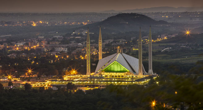
The city was built during the 1960s to replace Karachi as Pakistan's
capital. Islamabad is a well-organised international city divided into
several different sectors and zones. It is regarded as the most developed
city in Pakistan.
Islamabad is located in the Pothohar Plateau in the northeastern part
of the country, within the Islamabad Capital Territory.
The region has historically been a part of the crossroads of
Punjab and Khyber Pakhtunkhwa with the Margalla Pass acting as
the gateway between the two regions.[5] ther are four cities.
The city was built during the 1960s to replace Karachi as Pakistan's
capital. Islamabad is a well-organised international city divided into
several different sectors and zones. It is regarded as the most developed
city in Pakistan.
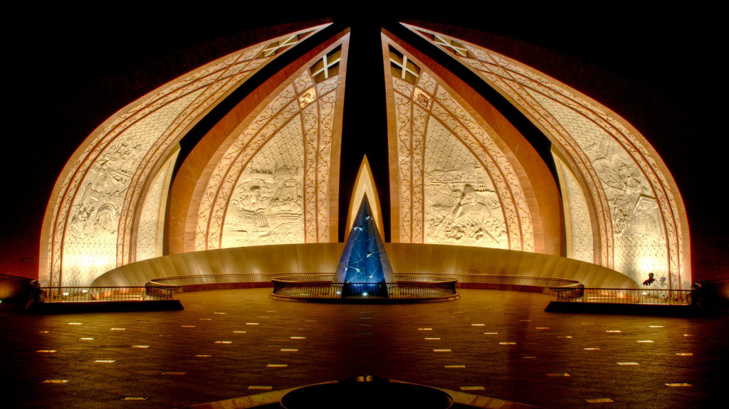
The Pakistan Monument in Islamabad, Pakistan, is a national monument
representing the nation's four provinces and three territories.
After a competition among many renowned architects, Arif Masood’s plan
was selected for the final design. The blooming flower shape of the monument
represents Pakistan's progress as a rapidly developing country. The four
main petals of the monument represent the four provinces (Balochistan,
Khyber-Pakhtunkhwa, Punjab, and Sindh), while the three smaller petals
represent the three territories (Gilgit-Baltistan, Azad Kashmir and the
Federally Administered Tribal Areas). The Monument has been designed to
reflect the culture and civilization of the country and depicts the story
of the Pakistan Movement, dedicated to those who sacrificed themselves for
future generations.
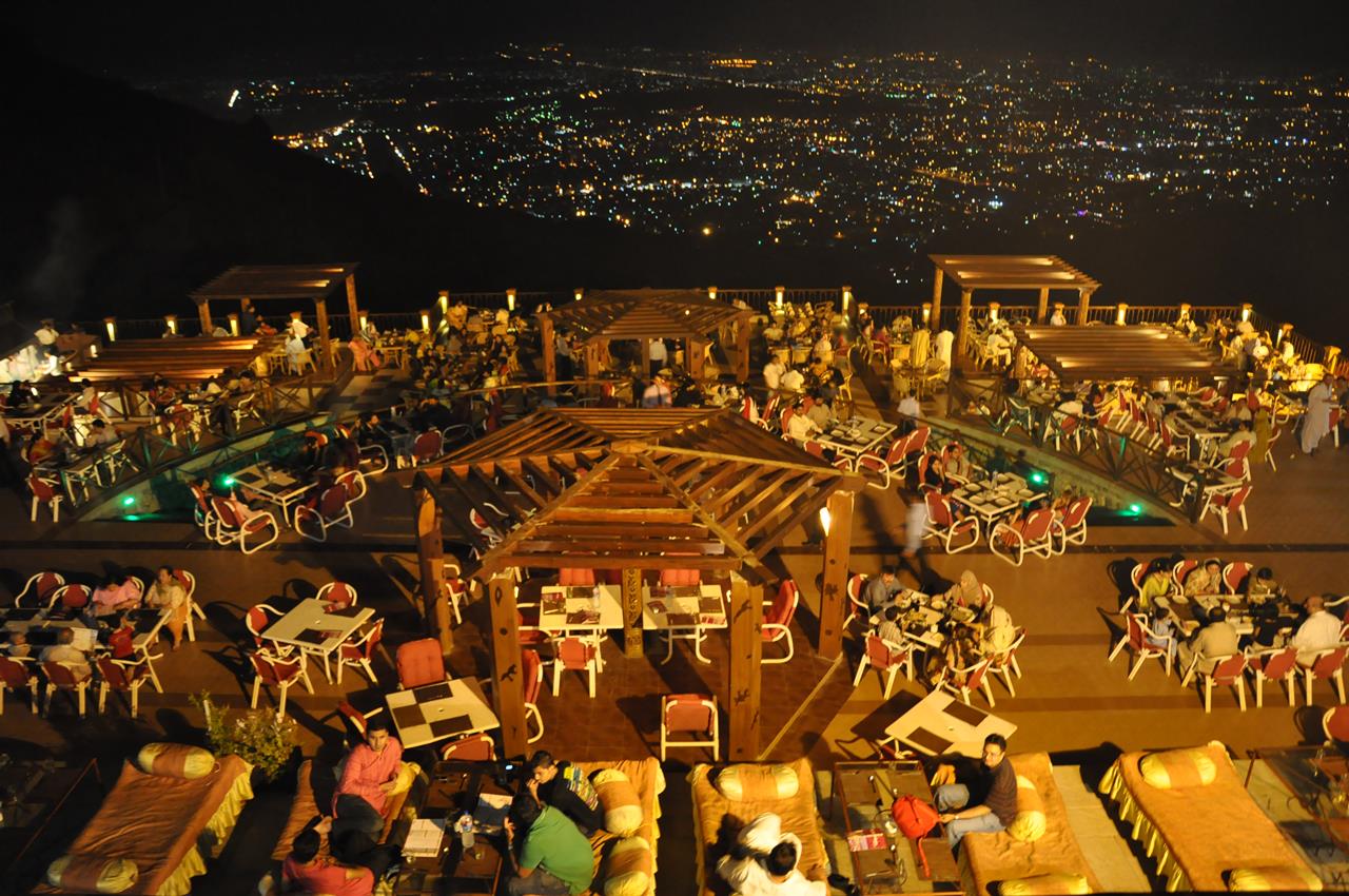
Pir Sohawa is a rapidly developing tourist resort located 17 kilometers (11 mi)
from Islamabad on top of Margalla Hills. It has a 3000 plus ft elevation and
located in Monal village which is geographically part of Haripur District.On 6
January 2012, after almost six years, Pir Sohawa, the city’s highest tourist spot,
received few inches of snowfall.